War Map, presented by The Map House, is an extraordinary exhibition comprising of fifty years of original pictorial conflict maps.
The exhibition has been carefully curated by a team of experts from The Map House, an established London dealer of original antique and vintage maps with over 100 years experience in the field of cartography.
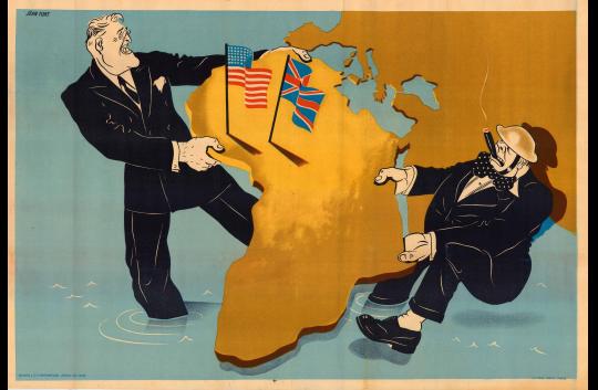
From 1900 to 1950, the international political landscape was irreversibly changed by regional and global conflicts. Taking in the end of the Boer War, the Russian Civil War and two World Wars, War Map explores the propaganda campaign maps produced during this period.
The exhibited maps not only provide a historical insight into the turbulent first half of the twentieth century but also function as beautiful art pieces.
War Map: Pictorial Conflict Maps, 1900-1950
The Map House, 54 Beauchamp Place, Knightsbridge
Ad
Event has ended
This event ended on Friday 18th of November 2016
This event ended on Friday 18th of November 2016
Admission
Free
Free
Tags:
Art
User Reviews
There are no user reviews